What is Sentinel-1? When and how to use it?

Michael Yushchuk
Head of Data Science
What is Sentinel-1?
The Sentinel-1 mission is the European Radar Observatory for the Copernicus joint initiative of the European Commission (EC) and the European Space Agency (ESA). Copernicus is a European initiative to implement information services dealing with the environment and security based on observation data from Earth Observation satellites and ground-based information.
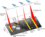
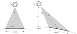
The mission consists of a constellation of Sentinel-1A and Sentinel-1B, sharing the same orbital plane. The orbit has a 12-day repeat cycle and completes 175 orbits per cycle. Sentinel-1 operates in four exclusive acquisition modes – Stripmap (SM), Interferometric Wide swath (IW), Extra-Wide swath (EW), and Wave (WV), each having advantages and disadvantages. The most widely used is the IW mode. Both Sentinel-1 spacecraft carry a single SAR instrument operating at a center frequency of 5.405 GHz.

What is SAR?
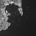
Synthetic-aperture radar (SAR) is a form of radar. SAR is used to create two-dimensional images or three-dimensional reconstructions of objects, such as landscapes. SAR uses the motion of the radar antenna over a target region to provide better spatial resolution than conventional beam-scanning radars. SAR can operate at wavelengths not impeded by cloud cover or a lack of illumination and can acquire data over a site during the day or nighttime under all weather conditions. Sentinel-1, with its C-SAR instrument, can offer reliable, repeated wide-area monitoring.

Sentinel-1 applications and advantages over other satellite imagery
The main applications of Sentinel-1, according to ESA, are as follows:
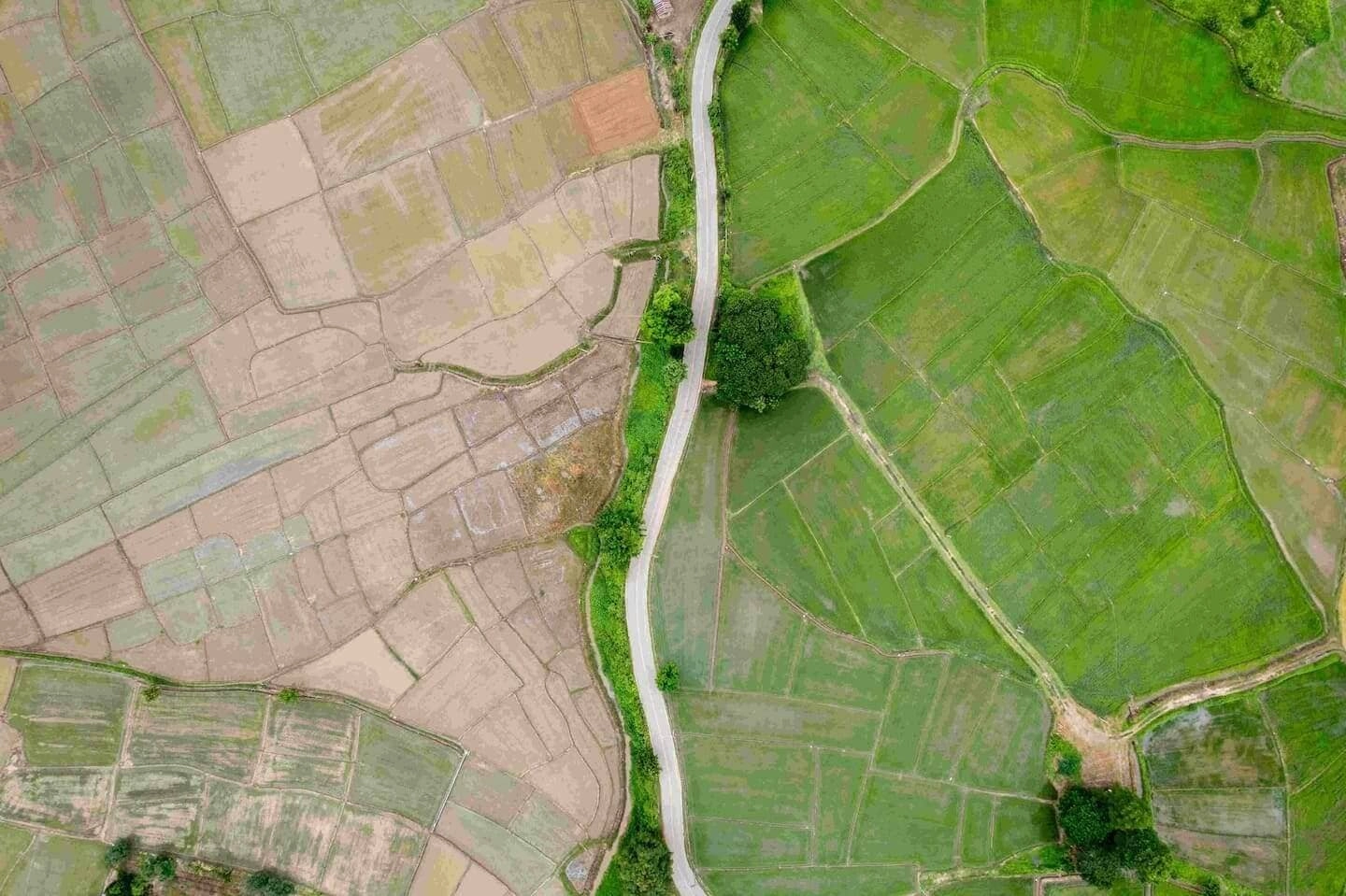
- Land Monitoring (forestry, agriculture)
- Maritime Monitoring (ice and ship recognizing)
- Emergency Management (volcano and flood observing)

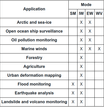
As mentioned above, Sentinel-1’s performance is independent of available daylight and visibility. That’s why it is frequently preferable to optical imaging for these applications. Alternatively, you can acquire Sentinel-1 images for free through different UIs, e.g., Copernicus Open Access Hub, or by directly using their API. Sentinel-1 has a decent revision time – S1A and S1B satellites have a combined repeat cycle of 6 days while providing a high resolution of 20m per pixel for Ground Range Detected products. All these advantages make Sentinel-1 one of the most popular SAR satellites in research and production environments.
Challenges of using Sentinel-1 images
Despite all of the above, there are still some challenges to overcome in using Sentinel-1 imagery in your projects.
Firstly, due to the side-looking nature of SAR images and the way level-1 products are generated, there are some issues with image quality. For example, they are geometrically distorted and have some noise added. You will need to run a preprocessing pipeline to deal with the problem. The best option would be to use the ESA Sentinel Application Platform (SNAP), which has most of the tools to fix these problems as part of the Sentinel-1 toolbox.

Another issue found when using Copernicus Open Access Hub to download Sentinel-1 is that images older than one year move into a long-term archive. To retrieve such pictures, you will need to request that they be brought back online and only download them. In case you might not want to wait another day before downloading the images you need, you will have to use other download services that aren’t free.
Sentinel-1 preprocessing
Sentinel-1 images require preprocessing. You could use a desktop version of SNAP. However, it doesn’t fit the criteria if you want to automate this preprocessing step. Therefore, a command-line interface exists for using SNAP operators called GPT (Graph Processing Tool). It takes in an XML file with a predefined preprocessing pipeline. It runs the same preprocessing steps as if you were using a desktop version. The most uninvolved command-line call would look something like this:
gpt my_graph.xml -Pinput input.file -Poutput output.fileOther than that, community-driven libraries like pyroSAR create an interface for using SNAP operators and GPT. Suppose you are looking for a set of operators that would be good to use in your Sentinel-1 preprocessing. In that case, the following article addresses some of the Sentinel-1 issues, like the correction of geometric distortions and noise removal using SNAP operators.
The list of operators from this article looks like this:
- Apply orbit file (Apply-Orbit-File in SNAP)
- Thermal noise removal (ThermalNoiseRemoval in SNAP)
- Border noise removal (Remove-GRD-Border-Noise in SNAP)
- Calibration (Calibration-Sigma in SNAP)
- Speckle filtering (Speckle-Filter in SNAP)
- Range Doppler Terrain Correction (Terrain-Correction in SNAP)
- Conversion to dB (LinearToFromdB in SNAP)
How we use Sentinel-1 images
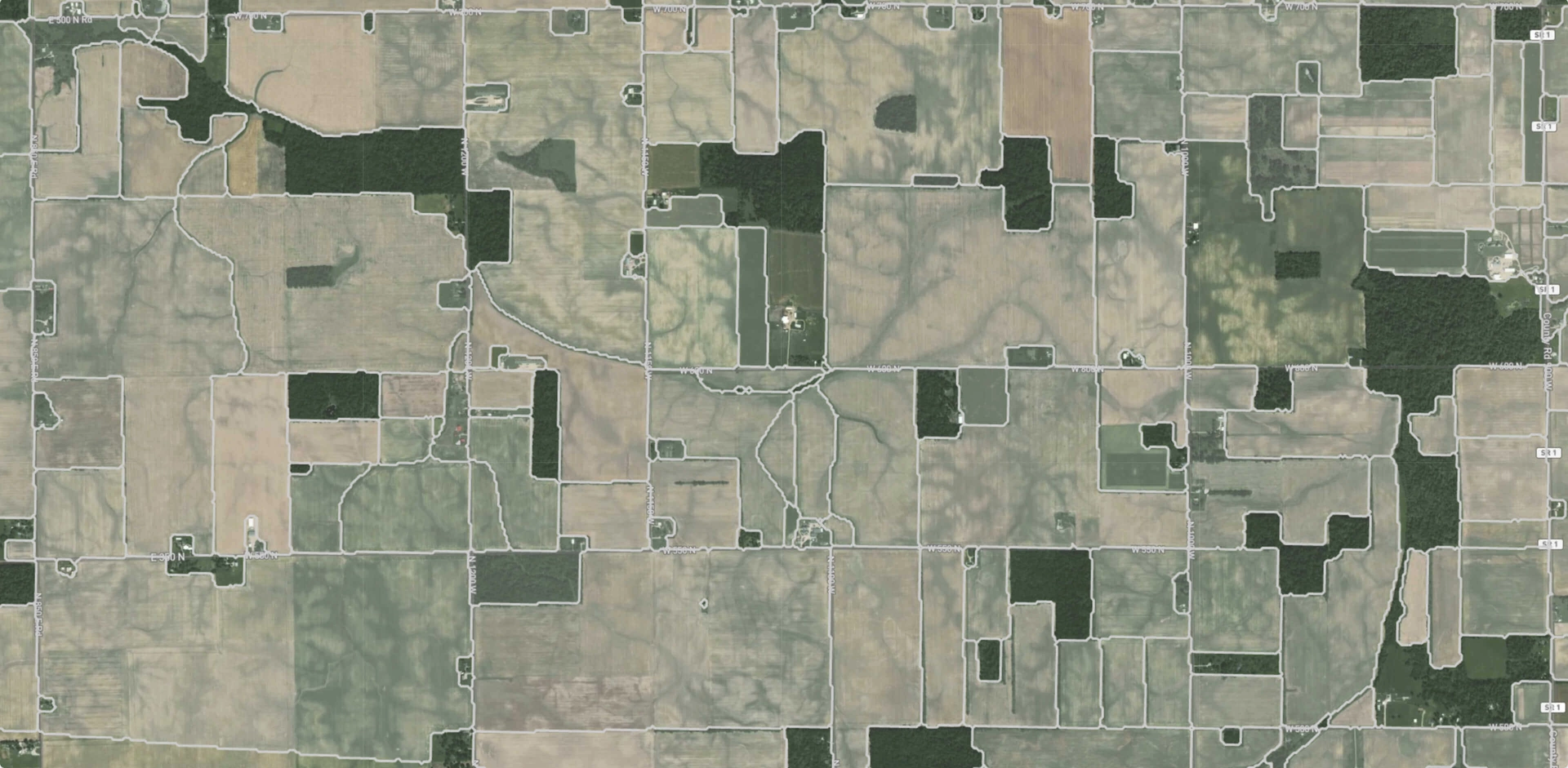
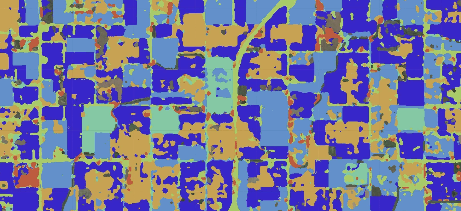
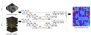
GeoAP is the product where we used Sentinel-1 SAR images alongside Sentinel-2 optical images to create crop classification maps that tell you specified crops to grow in agricultural fields. Even though we didn’t use just Sentinel-1 images alone to solve this task, Sentinel-1 is an excellent addition to Sentinel-2, increasing our accuracy by at least 5% across all of our experiments. In short, we’ve built time series of Sentinel-1 and Sentinel-2 images over a specific region and used convolutional neural networks to produce crop classification maps, as shown in the picture below. The method we used is based on this article.

Conclusion
The Sentinel-1 mission is based on a collection of satellites that acquire images of the Earth’s surface using synthetic-aperture radar. Images are provided weekly and are of high resolution. The images’ quality doesn’t depend on the weather conditions or the time of day they were taken. Sentinel-1 can be used in land monitoring, maritime monitoring, and emergency management. There are some challenges to using Sentinel-1, but you can easily overcome them.
Hopefully, this article gave you insight into what Sentinel-1 images are and how to use them.